![](/images/other/stat-length.png)
![Tour Wandern Les Plans - Forêt et cirque de Labeil - Photo](https://media.geolcdn.com/t/1900/400/ext.pjpeg?maxdim=2&url=https%3A%2F%2Fmedia.geolcdn.com%2Ff%2F21b3d7b0-35ee-491f-98e6-53e535349997.jpg)
Forêt et cirque de Labeil
Raymond DAVID
Benutzer
![Länge](/images/other/stat-length.png)
Länge
12,5 km
![Maximale Höhe](https://static1.geolcdn.com/siteimages/upload/files/1508320355ic_sort_altitude_max_24dp.png)
Maximale Höhe
846 m
![Positive Höhendifferenz](https://static1.geolcdn.com/siteimages/upload/files/1508320355ic_sort_den_pos_24dp.png)
Positive Höhendifferenz
317 m
![Km-Effort](/images/other/stat-length.png)
Km-Effort
16,7 km
![Min. Höhe](https://static1.geolcdn.com/siteimages/upload/files/1508320355ic_sort_altitude_min_24dp.png)
Min. Höhe
660 m
![Negative Höhendifferenz](https://static1.geolcdn.com/siteimages/upload/files/1508320355ic_sort_den_neg_24dp.png)
Negative Höhendifferenz
323 m
![Boucle](https://static1.geolcdn.com/siteimages/upload/files/16400158638029165_repeat_loop_refresh_sync_direction_icon.png)
Boucle
Ja
Erstellungsdatum :
2024-06-16 07:14:59.161
Letzte Änderung :
2024-06-21 09:29:34.271
![Wandern](https://static1.geolcdn.com/sitytour/trail-icons/101.png)
4h30
Schwierigkeit : Einfach
![Scannen Sie diesen QR-Code, um die Tour in der SityTrail-Anwendung zu öffnen](https://capi.geolives.com/qq0zvz2zws4bq2lad0pu/sitytour/trails/4098071/qr.png?size=200)
Kostenlosegpshiking-Anwendung
Über SityTrail
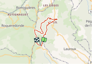
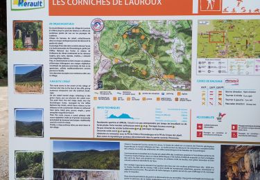
Tour Wandern von 12,5 km verfügbar auf Okzitanien, Hérault, Les Plans. Diese Tour wird von Raymond DAVID vorgeschlagen.
Beschreibung
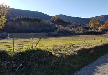
Parking au-dessus du hameau du Perthus (D 902).
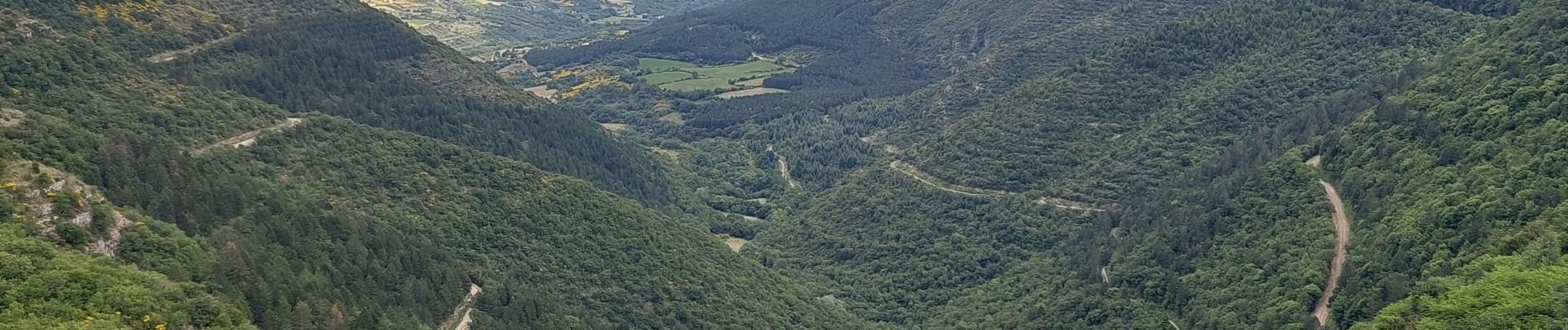
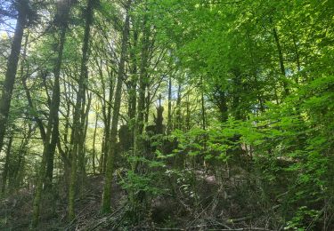
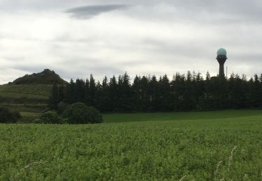
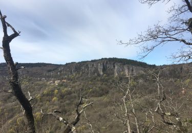
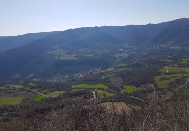
Agréable randonnée très ombragée. De beaux points de vue.
Ort
Land:
France
Region :
Okzitanien
Abteilung/Provinz :
Hérault
Kommune :
Les Plans
Standort:
Unknown
Gehen Sie:(Dec)
Gehen Sie:(UTM)
520108 ; 4847611 (31T) N.
Kommentare
Touren in der Umgebung
![Tour Nordic Walking Joncels - RANDONNÉE JONCELS CIRCUIT ARCHÉOLOGIQUE - Photo](https://media.geolcdn.com/t/375/260/ext.jpg?maxdim=2&url=https%3A%2F%2Fmedia.geolcdn.com%2Ff%2F0eb6a312-d62e-40e4-973b-25f789da995e.png)
![Nordic Walking Nordic Walking](https://static1.geolcdn.com/sitytour/trail-icons/102.png)
RANDONNÉE JONCELS CIRCUIT ARCHÉOLOGIQUE
Nordic Walking
Einfach
(1)
Joncels,
Okzitanien,
Hérault,
France
![](/images/other/stat-length.png)
8,9 km | 12 km-effort
2h 20min
![](https://static1.geolcdn.com/siteimages/upload/files/16400158638029165_repeat_loop_refresh_sync_direction_icon.png)
Ja
![Tour Nordic Walking Lauroux - SityTrail - Labeil Forêt de l'Escandorgue Juin 2021 - Photo](https://media.geolcdn.com/t/375/260/ext.jpg?maxdim=2&url=https%3A%2F%2Fmedia.geolcdn.com%2Ff%2Fc2282928-f752-4149-927b-0f9ea4e169ca.jpg)
![Nordic Walking Nordic Walking](https://static1.geolcdn.com/sitytour/trail-icons/102.png)
SityTrail - Labeil Forêt de l'Escandorgue Juin 2021
Nordic Walking
Einfach
(1)
Lauroux,
Okzitanien,
Hérault,
France
![](/images/other/stat-length.png)
9,3 km | 12,5 km-effort
Unbekannt
![](https://static1.geolcdn.com/siteimages/upload/files/16400158638029165_repeat_loop_refresh_sync_direction_icon.png)
Ja
![Tour Wandern Les Plans - Forêt domaniale d'Escandorgue par Roqueredonde et l'Engayresque - Photo](https://media.geolcdn.com/t/375/260/ext.jpg?maxdim=2&url=https%3A%2F%2Fmedia.geolcdn.com%2Ff%2Fc203cd03-9ac1-4e05-8a4c-6b4e6f9317be.jpg)
![Wandern Wandern](https://static1.geolcdn.com/sitytour/trail-icons/101.png)
Forêt domaniale d'Escandorgue par Roqueredonde et l'Engayresque
Wandern
Medium
(1)
Les Plans,
Okzitanien,
Hérault,
France
![](/images/other/stat-length.png)
14,2 km | 19,7 km-effort
5h 2min
![](https://static1.geolcdn.com/siteimages/upload/files/16400158638029165_repeat_loop_refresh_sync_direction_icon.png)
Ja
![Tour Wandern Lauroux - les corniches de lauroux - Photo](https://media.geolcdn.com/t/375/260/ext.jpg?maxdim=2&url=https%3A%2F%2Fservices.sitytrail.com%2FGeolivesWS%2FDownloadMedia.ashx%3FTrailID%3D333456%26Media%3D20140811173610.jpg)
![Wandern Wandern](https://static1.geolcdn.com/sitytour/trail-icons/101.png)
les corniches de lauroux
Wandern
Schwierig
(1)
Lauroux,
Okzitanien,
Hérault,
France
![](/images/other/stat-length.png)
15,5 km | 24 km-effort
5h 4min
![](https://static1.geolcdn.com/siteimages/upload/files/16400158638029165_repeat_loop_refresh_sync_direction_icon.png)
Ja
![Tour Wandern Lauroux - cirque de labeil - Photo](https://media.geolcdn.com/t/375/260/ext.jpg?maxdim=2&url=https%3A%2F%2Fservices.sitytrail.com%2FGeolivesWS%2FDownloadMedia.ashx%3FTrailID%3D199890%26Media%3D20130622153523.jpg)
![Wandern Wandern](https://static1.geolcdn.com/sitytour/trail-icons/101.png)
cirque de labeil
Wandern
Einfach
(2)
Lauroux,
Okzitanien,
Hérault,
France
![](/images/other/stat-length.png)
10,7 km | 14,1 km-effort
3h 4min
![](https://static1.geolcdn.com/siteimages/upload/files/16400158638029165_repeat_loop_refresh_sync_direction_icon.png)
Ja
![Tour Wandern Lauroux - Lauroux (cirque de Labeil, l'Escandorgue) - Photo](https://media.geolcdn.com/t/375/260/ext.jpg?maxdim=2&url=https%3A%2F%2Fstatic1.geolcdn.com%2Fsiteimages%2Fupload%2Ffiles%2F1553511878bg_sport_marche.png)
![Wandern Wandern](https://static1.geolcdn.com/sitytour/trail-icons/101.png)
Lauroux (cirque de Labeil, l'Escandorgue)
Wandern
Einfach
(1)
Lauroux,
Okzitanien,
Hérault,
France
![](/images/other/stat-length.png)
13,3 km | 18,5 km-effort
5h 22min
![](https://static1.geolcdn.com/siteimages/upload/files/16400158638029165_repeat_loop_refresh_sync_direction_icon.png)
Ja
![Tour Wandern Lauroux - Cirque de Labeil - Lauroux-Labeil - Photo](https://media.geolcdn.com/t/375/260/ext.jpg?maxdim=2&url=https%3A%2F%2Fmedia.geolcdn.com%2Ff%2F8fdc9c8b-a7e7-4b91-a76e-1064fb68239e.jpg)
![Wandern Wandern](https://static1.geolcdn.com/sitytour/trail-icons/101.png)
Cirque de Labeil - Lauroux-Labeil
Wandern
Sehr schwierig
Lauroux,
Okzitanien,
Hérault,
France
![](/images/other/stat-length.png)
13,5 km | 21 km-effort
4h 47min
![](https://static1.geolcdn.com/siteimages/upload/files/16400158638029165_repeat_loop_refresh_sync_direction_icon.png)
Ja
![Tour Wandern Lauroux - les corniches de Lauroux - Photo](https://media.geolcdn.com/t/375/260/ext.jpg?maxdim=2&url=https%3A%2F%2Fmedia.geolcdn.com%2Ff%2F30247f3d-9089-4d90-9b6f-cf266f5c907e.jpg)
![Wandern Wandern](https://static1.geolcdn.com/sitytour/trail-icons/101.png)
les corniches de Lauroux
Wandern
Schwierig
Lauroux,
Okzitanien,
Hérault,
France
![](/images/other/stat-length.png)
16,3 km | 25 km-effort
5h 31min
![](https://static1.geolcdn.com/siteimages/upload/files/16400158638029165_repeat_loop_refresh_sync_direction_icon.png)
Ja
![Tour Nordic Walking Les Plans - La Fous - Mont Mayres - Grézac - Photo](https://media.geolcdn.com/t/375/260/ext.jpg?maxdim=2&url=https%3A%2F%2Fmedia.geolcdn.com%2Ff%2Fe27e9449-59e8-4673-bdcb-2016bec0049f.PNG)
![Nordic Walking Nordic Walking](https://static1.geolcdn.com/sitytour/trail-icons/102.png)
La Fous - Mont Mayres - Grézac
Nordic Walking
Einfach
Les Plans,
Okzitanien,
Hérault,
France
![](/images/other/stat-length.png)
7,8 km | 10,6 km-effort
2h 11min
![](https://static1.geolcdn.com/siteimages/upload/files/16400158638029165_repeat_loop_refresh_sync_direction_icon.png)
Ja